
Turning Aerial Data Into Detailed, Accurate Maps.
"Schedule An Instant Appointment Booking With DroneWays"
Connected
Cartography Services – Precision Mapping Solutions by DroneWays
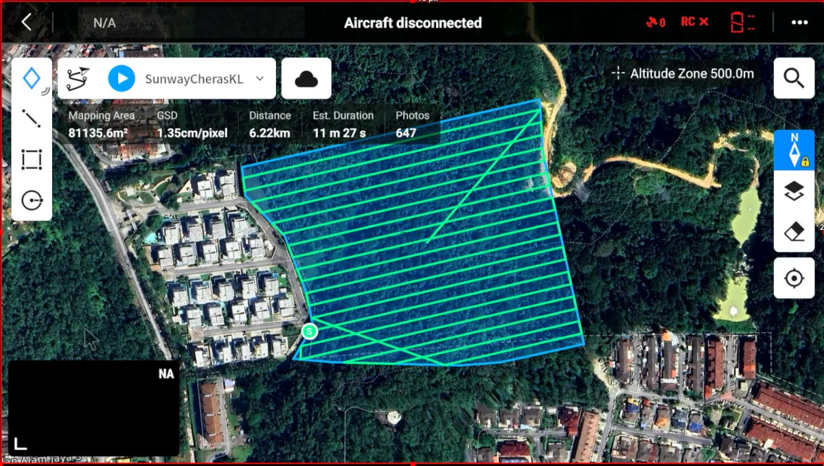
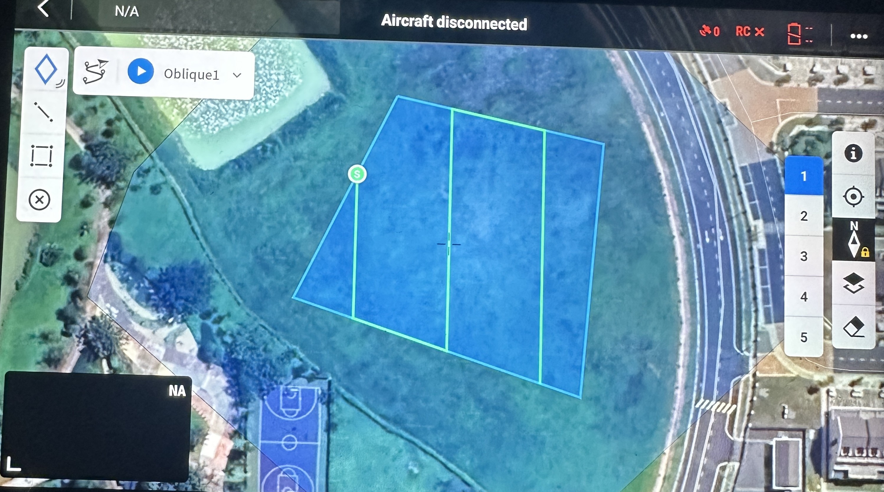
Our Cartographic Capabilities
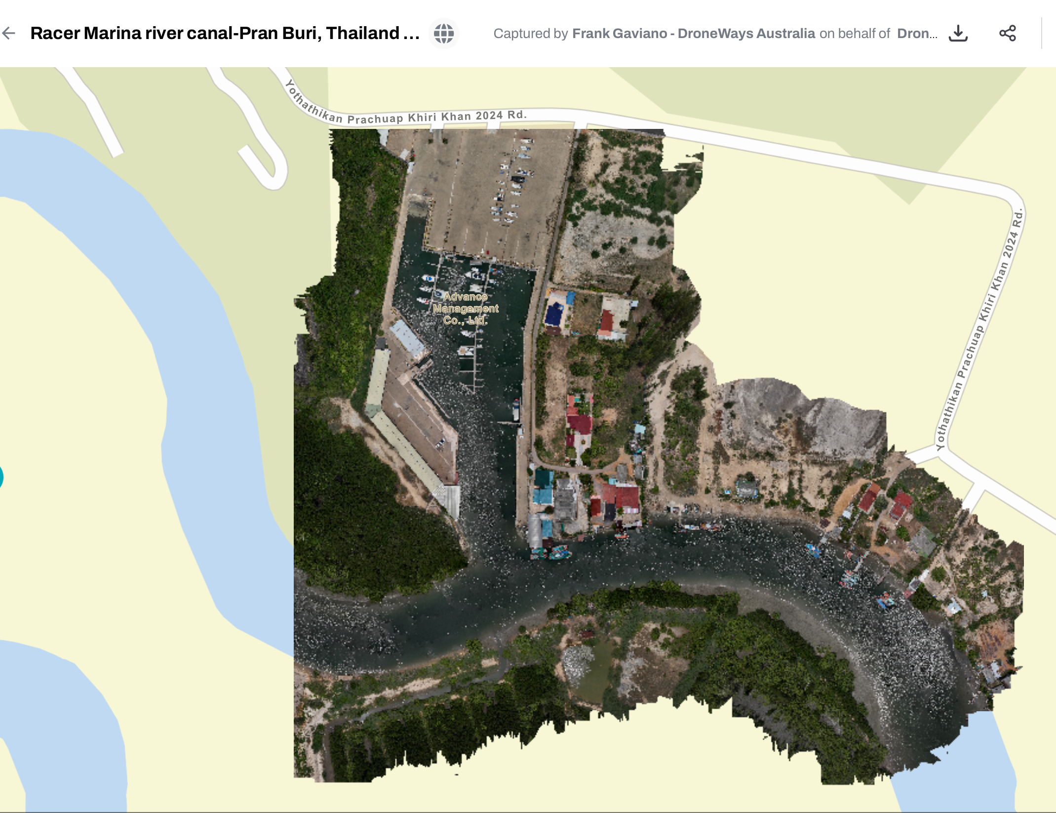
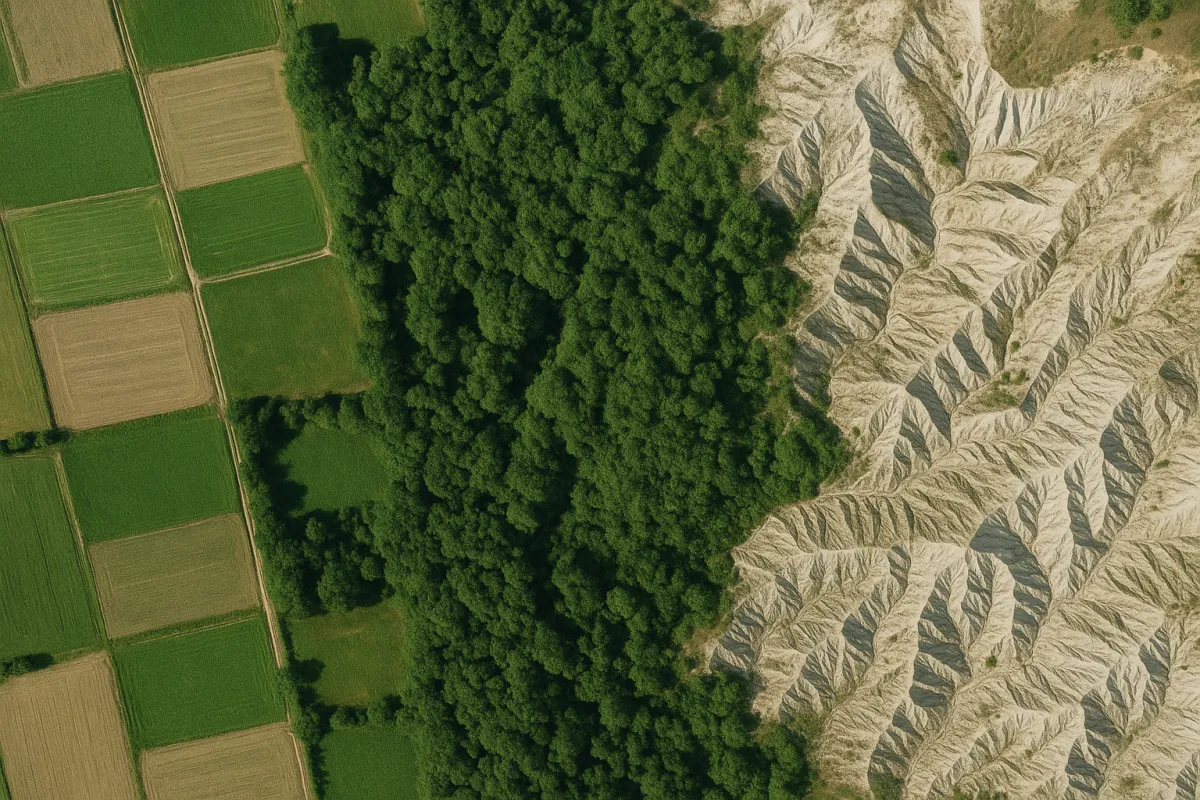
Land Use & Development Mapping
Urban planning
Site development proposals
Land allocation and zoning
Property boundary visualization
Infrastructure layout planning


Cartography! We Got You Covered.
Why Choose DroneWays
More than drone shots we deliver
insights that drive progress.
Here’s what makes us different from just another drone service provider:

Certified Expertise

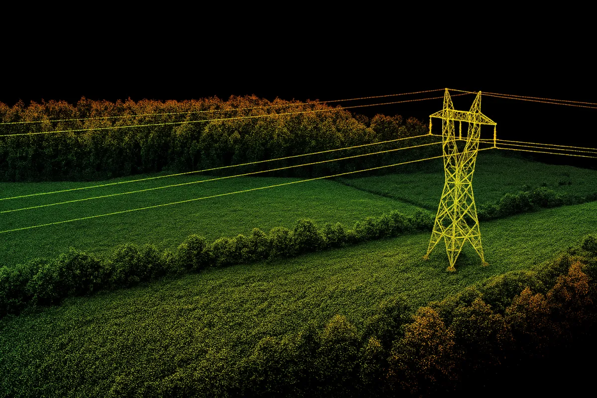
Precision Technology
We use the latest drone systems and sensors to ensure centimeter-level accuracy in every project.
End-to-End Solutions
From flight planning to data analysis, DroneWays manages the full process — so you can focus on your goals.

Transparent Reporting
Get clear visuals, measurable data, and easy-to-read analytics you can trust for real decisions.
Our success is measured by how clearly you see yours.
Why partner with DroneWays?
Choosing Drone Ways means choosing reliability, expertise, and quality.
Certified & insured drone pilots
Professional-grade equipment
Transparent safety procedures
Fast turnaround on reports & deliverables
Customizable data outputs
Competitive pricing
Dependable customer support
Ready to Start Your Project?
Whether you’re planning an inspection, survey, or specialized operation, Drone Ways is ready to help.
At DroneWays, we deliver precision, innovation, and data-driven drone solutions — from mapping and surveying to 3D modelling and aerial inspections.
Our Services
Drone Mapping
Aerial Surveying
3D Modelling
Data Analytics
Consultation